Slug: navy-noaa-weather-data-cut-impact
Meta Description (under 150 characters):
The U.S. Navy plans to stop sharing satellite weather data with NOAA. Here’s what that means for public forecasts, safety, and national security.
Introduction: A Decision That Could Affect Millions
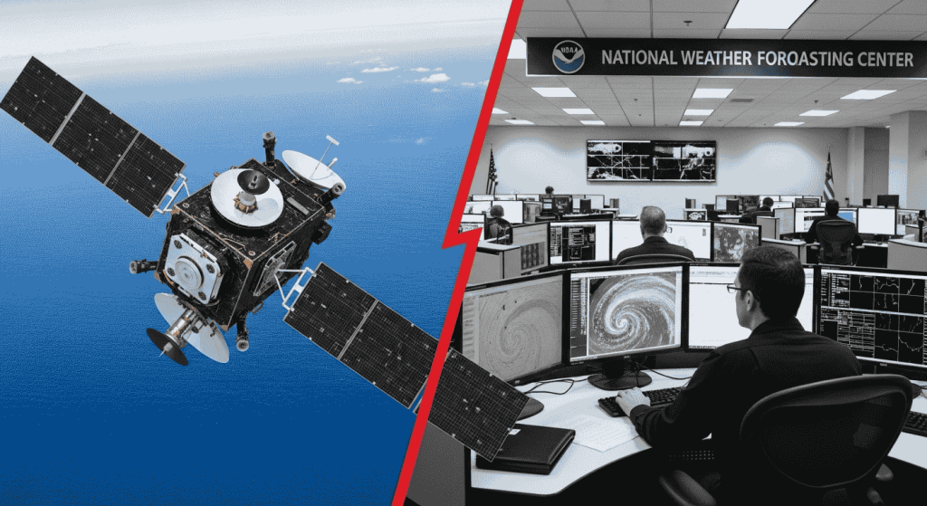
In a decision that’s quietly sending shockwaves through the forecasting and scientific communities, the U.S. Navy will soon stop sharing its satellite weather data with NOAA—a move that could impact everything from hurricane predictions to flight safety.
While the announcement may sound technical, its ripple effects are deeply human. Weather affects every part of our daily lives—what we wear, how we travel, when we evacuate, and even how we farm or fish. So, why is this happening, and why should you care?
What’s Happening? The Navy Is Changing the Rules
The U.S. Navy recently confirmed plans to halt the transfer of certain satellite-based weather data to the National Oceanic and Atmospheric Administration (NOAA) by late 2025. This isn’t about stopping all collaboration—but a clear sign that the military is tightening control over how its weather intelligence is used outside defense operations.
Traditionally, NOAA—responsible for America’s public weather forecasts—has relied on multiple sources: its own satellites, international partners, and high-value military satellite data from the Navy and Air Force. This military data has filled gaps, especially over oceans and in remote areas.
Why Is the Navy Doing This?
There are three key reasons behind the Navy’s decision:
1. Protecting Operational Security
Military satellites do more than just capture cloud patterns. They may also track missile activity, monitor foreign territories, or support combat missions. Navy officials argue that sharing raw data could unintentionally reveal classified capabilities or surveillance locations.
2. Reducing Duplication
Today, NOAA’s own satellite network is more powerful than ever. With systems like GOES-16 and JPSS-2, NOAA can independently gather much of the data it once depended on from the military. The Navy sees this as an opportunity to consolidate and focus its weather efforts strictly on defense priorities.
3. Realigning for Tactical Advantage
Modern warfare increasingly depends on real-time environmental data. The Navy wants to prioritize its weather assets for naval operations, overseas deployments, and strategic decision-making—not just public forecasting.
But What Does This Mean for Regular People?
This is where things get personal. Because when fewer data streams feed into our national weather systems, the forecasts we all rely on may become less accurate or slower to update—especially in high-risk zones.
1. Slower Hurricane and Storm Tracking
Military satellites are often the first to capture storm developments over distant oceans. Without that data, NOAA may have fewer early signals—making it harder to give coastal communities enough warning to evacuate.
2. Riskier Flights and Shipping Routes
Airlines, pilots, and shipping crews depend on NOAA’s aviation and marine forecasts, which are enhanced by Navy inputs. With a data gap, routes may become riskier, or more conservative (and costly) to compensate for uncertainty.
3. Disrupted Emergency Planning
FEMA and local governments rely heavily on NOAA’s models during wildfires, floods, and winter storms. If NOAA’s forecasts become less precise, emergency response times could lag, increasing the chance of property damage or loss of life.
4. Weaker Climate Models
Long-term climate science relies on historical weather data. Military satellites have helped fill in gaps over the past 30 years. A cutoff could disrupt the continuity of climate trend tracking, especially in the oceans and polar regions.
How Has NOAA Reacted?
Publicly, NOAA has remained cautious but committed. Spokespersons have said the agency is evaluating the situation and working closely with the Department of Defense.
Behind the scenes, however, sources suggest NOAA is racing to secure alternative data pipelines, including:
- Expanding its own satellite programs (GOES-U, JPSS-3)
- Buying commercial satellite data from private weather companies
- Working with international space agencies like EUMETSAT and JAXA
What Do Experts Say?
Many in the scientific community are alarmed.
“This is not just a bureaucratic change—it’s a potential public safety issue,”
says Dr. Hannah Miles, a meteorologist at MIT.
“We’ve built our forecasting systems on shared infrastructure. If you remove a key pillar, everything shakes.”
Some experts are also concerned this may signal a broader trend of militarizing environmental data, which has traditionally been open and collaborative.
Could This Decision Be Reversed?
Possibly. Lawmakers from coastal states and disaster-prone regions have begun asking tough questions. Some are preparing legislation that would require the military to continue sharing non-sensitive weather data with NOAA.
There are also talks of compromise: for instance, sharing filtered or encrypted data that removes classified metadata but keeps core weather information usable.
Others propose a neutral data hub—managed by NASA or a civilian entity—that acts as a middle layer between NOAA and the Navy.
What Can NOAA Do Without the Navy?
To be fair, NOAA isn’t powerless. In recent years, the agency has invested heavily in:
- Artificial intelligence for forecast modeling
- Crowdsourced weather data (from ships, airplanes, and citizen weather stations)
- Advanced computer models like FV3 and UFS
Still, these systems work best when they’re fed rich, real-time satellite data—and the Navy’s satellites have provided exactly that.
May You Like
Canyon Lake on Edge After Fierce Storms Trigger Emergency Alert
Increased Security at Hampton Beach for July 4 Following June Shootings
Canyon Lake Water Levels Surge: Is the Guadalupe River Dam at Risk of Overflowing?
Canyon Lake on High Alert After Powerful Storms Strike the Area
Why You Should Care—even If You’re Not a Scientist
This may seem like an inside-the-Beltway squabble. But think about this:
- Would you board a flight knowing the weather system might miss a high-altitude wind shift?
- Would your city be ready if a hurricane turned suddenly and NOAA didn’t see it in time?
- Would your crops survive if climate trend data became unreliable?
Weather is one of those public goods we all depend on. When that system weakens—even a little—it introduces risk into everyday life.
What’s Next: A Weather Forecast for Uncertainty
Unless Congress intervenes or a new data-sharing agreement is crafted, the Navy’s weather feed to NOAA will go dark by December 2025. That gives NOAA just over a year to fill the data gap, adjust its models, and keep public forecasting robust.
Will they succeed? Possibly. But even a brief disruption could have consequences—especially as extreme weather becomes more frequent due to climate change.
Conclusion: The Sky Is Watching—But Who Controls the View?
The U.S. Navy’s decision to withhold satellite weather data from NOAA isn’t just a technical change—it’s a major shift in how America manages one of its most vital assets: timely, accurate, life-saving weather intelligence.
Whether this change ultimately improves security or erodes public trust in forecasts will depend on what comes next: cooperation, investment, and public awareness.
Because while satellites may be orbiting far above, their impact lands right here—on our homes, our jobs, and our future.
External Trusted Links for Further Reading
- NOAA National Environmental Satellite, Data, and Information Service (NESDIS)
- U.S. Naval Meteorology and Oceanography Command
- Congressional Research Service: Weather and National Security
Image Prompt (for AI Generation)

